My 65+ mile walk from Sutton Coldfield, Birmingham to my home in Mansfield, Nottinghamshire.
Sunday morning 16th July, 2017. 05.00 hrs:
Genesis.
My first track - from the Lakeside at Sutton Coldfield to the Ventura Shopping centre, Tamworth - also includes my bus journey back to Sutton Coldfield AND my car journey back to the Ventura Shopping Centre from Sutton ‘cos I hadn’t managed to successfully switch off my tracker: http://my.viewranger.com/track/details/NTQ2NDQ2Mg==
Having parked up my SMB (Small Mobile Bedroom) overnight at the bottom of Wyndley Lane beside the lake, I’m awakened from my slumbers by the cackling and calling of ducks and the honking of geese on the lake. This was after attending Jonny and Tanya Cooper’s garden party and imbibing a little too much liquid refreshment. I had a bit of a hangover, but by 06.00 hrs I had eaten a few biscuits, a banana, taken my life support pills and was on my way walking the sixty five+ miles back home.
My target for the day was intended to be Ashby de la Zouch, but due to certain circumstances/events (including me stopping off at a pub in Tamworth to watch the British F1 Grand Prix on wide-screen TV over a couple of pints of amber nectar, I only managed to get as close to the village of Shuttington, a village just a few miles NE of Tamworth.
However, before getting to that point. That morning I’d previously reached the Ventura Shopping Centre in Tamworth and then immediately caught a bus I’d spotted coming towards me with Sutton on the destination board that just happened to be there at the same time - back to Sutton Coldfield so's I could pick up my SMB.
I then drove the SMB back to The Ventura Shopping centre and parked it there.

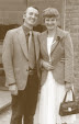
- Left
- Centre
- Right
Remove
Same day, mid afternoon, Sunday 16th July:
My track from The Armington Flaming Grill to very nearly the village of Shuttington near Tamworth: http://my.viewranger.com/track/details/NTQ2NDQ2Mw==
Once more I set off towards Ashby de la Zouch. It was getting on for 12.30 hrs when I came across a pub, The Armington Flaming Grill. It looked interesting. I entered, walked up to the bar and asked if there was any chance of me be being able to sit and watch the British F1 Grand Prix on their wide screen TV and they said OK, it would be on at one o’clock. So I got myself a pint and spent about two and a half hours in that pub watching it.
NB. Britain’s Lewis Hamilton won it easily.
After the F1 race I set off once again and joined the canal which took me almost as far as the village of Shuttington. I decided at this point to call it a day. I stopped and turned back towards Tamworth to get back to my car from where I’d left it. I tried waiting for a bus.
I waited about 15 minutes and then thought bugger it, I’ll walk. So I walked the few miles back to the Ventura Shopping centre and once in my car I decided - reasoning that I might find better parking in Kegworth - to drive the twenty miles plus to Kegworth and walk back to Shuttingham on the morrow.
In Kegworth I found a pub called the Anchor Inn and asked for and got permission to park overnight AND the following day in their car park.

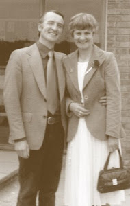
- Left
- Centre
- Right
Remove
Monday 17th July:
My track from The Anchor Inn, Kegworth, Leicestershire, back to Shuttington and slightly beyond. I wandered a bit off the original planned track ‘cos I inadvertently left an important map section back in the car: http://my.viewranger.com/track/details/NTQ2NDQ2NQ==
I was up bright and early for my walk back to Shuttington on a very warm day.
To do that leg of the walk I need the four OS maps that I had drawn in the detailed route using any available footpaths, cycle tracks, old railway lines and canals etc. and I had put four maps in my rucksack. However, I'd only walked about six miles and got to a point in the walk where I needed to change maps when then I realised I had packed one wrong map section of the walk!!! I’d left the most important map taking me to Ashby de la Zouch and beyond in the car!!
This meant that I had to busk it for about ten miles using just my known position map coords at any time and a compass bearing. This was only partially successful and got me into all sorts of dead ends and deviations. I made the most of what village pubs were open purely for medicinal purposes, local information and to get out of the interminable heat of the overbearing sun.
On one of the hottest days of the year I spent a lot of it yomping through half mile wide fields of two foot high potato plants trying to follow a path that I couldn't see. Crashing through fields of ripening rape seed that wanted to trip me up and drag me under, and wending my way through eight feet high seemingly never ending fields of maize or sweetcorn that was soaking wet and wetting me through from head to feet, only to find when I got to the other side of the field there was no way out.
No gate, no stile, not even a barb-wire fence, just a 12 foot high hawthorn hedge, which meant I had to turn either left or right and try to find an exit. I did two sides of the huge field before I came across a tiny break in the hedge. A bit of rickety fence festooned with rusty barbed wire. Beyond that bit of fence and across the field I could see a gate and traffic using a road beyond it.
So I took my jacket out of my bag, put it over the barbed wire and gingerly climbed over. Once on the other side I made a beeline through the cows for the gate across the pasture. When I reached the gate I soon discovered it was again covered in rusty barbed wire and I had to repeat the previous process. Safely over I was now on a road which, luckily for me, was on the course I wanted. The sun was still blazing and in no time at all I was once more dry.
I found that if I kept the A42 road and then eventually the M42 in my sight and walked somewhat parallel to either of them I couldn't be far off the track I'd intended. But at times this became impossible and I had to take a road or path obliquely to my intended route. My GPS tracker track makes it look like a spider has crawled all over a map and left muddy footprints.
Eventually I reached the village of Shuttington and I was knackard. It was around ten minutes to six and I needed a bus. I waited for a bus ( I waited almost an hour) to take me into Tamworth expecting to catch a bus to Kegworth or at least a bus to Nottingham where I knew I could get a bus to almost anywhere in the UK. I reached Tamworth centre around seven in the evening and my enquiries for transport by buses to either Kegworth or Nottingham bore no fruit. One bus driver suggest I take the train, but there is no train link to Kegworth.
So at that point I decided I WOULD take the train. I decided I would take the trains all the way to Nottingham, Mansfield and thus home. Reckoning that I could fill in the gap on the Tuesday by walking the twenty or so miles back to Kegworth from home.
However, by the time I'd spent the best part of four hours on buses, trains and the wife's car (she, bless her, picking me up at a late hour at the local train station in Mansfield) I was even more knackard than I have ever been in my life.
I also learned on arriving home that I had an appointment set for Wednesday 19th July at The City Hospital, Nottingham, for a PET scan . So I skipped the planned walk back to Kegworth the following day. BUT my car was still there, by the grace of the pub landlord, and I didn’t like breaking a promise.
So I rang The Anchor Inn at about ten in the evening and explained briefly the situation. I promised I'd be coming to Kegworth by public transport on the morrow to pick it up.

- Left
- Centre
- Right
Remove
Tuesday 18th July:
And this I did. I spent the biggest part of the Tuesday utilising my bus-pass and FOUR buses to claim it. I had a chat with the landlord of the Anchor Inn and thanked him, explaining that I would be coming back to Kegworth later in the week.
Wednesday 19th July:
My track from my home in Mansfield to City Hospital in Nottingham and on to Nottingham’s Victoria Bus Station: http://my.viewranger.com/track/details/NTQ2NDQ2Ng==
Today I hiked the dozen miles or so to City Hospital, Nottingham. My scan was booked for five in the afternoon which allowed me plenty of time and I knew THAT route like the back of my hand. It takes in lots of country walking, wood, the stately grounds of Newstead Abbey (once the home of the poet and playboy Lord Byron), a golf course, disused railway lines and sundry public footpaths. I arrived at the hospital at around one in the afternoon so with plenty of time spare I decided to walk a couple of miles more to the Victoria Bus Station in the centre of Nottingham. I figured that this would make it easier for my final leg that would join all of the dots up. I then caught the bus back to the City Hospital and found a pub. Well, the doc did say I had to keep my fluid levels up for the PET Scan.
By the bye. The PET scan is one of three scans I have had recently PLUS blood tests and consultations. Apparently my twelve year old cancer (first diagnosed twelve years ago and which I thought had been beaten) has decided to have another go at stopping me in my tracks. Mind you, I have been feeling a little run down of late.
Having walked the fourteen miles or so to City Hospital last Wednesday (including walking past the hospital and on to Victoria bus station and then taking a bus BACK to the hospital to have my late hour PET scan), I returned home by a bus that went a roundabout way back to Mansfield. I arrived in my home town well after the last local bus service had finished and had to walk the last one and a half miles home. I finally reached home at just after nine.
Thursday 20th July: I rested up. Took the missus down town and did a bit of shopping.

- Left
- Centre
- Right
Remove
Friday 21st July:
My track from Kegworth to Nottingham Victoria Bus Station: http://my.viewranger.com/track/details/NTQ2NDQ2Nw==
Back to Kegworth this morning using those same four buses I had used to reclaim my SMB.
I arrived there at The Anchor Inn around noon. The doors were shut. I set off in good spirits to join the dots by walking along the canals and rivers to Victoria Bus Station in Nottingham. From there I will take the Sprint Bus to Mansfield and take my wife out to a fish and chip dinner/supper at the Green Dragon pub. Lovely Jubbly!
Then it all went tits up.
I had envisioned that this shortish leg of about ten miles would be one of the easiest and most enjoyable parts of the walk I’d even mentioned this to my wife and had thought of doing it with neither map or compass. How wrong can one be.
I set off OK, straight down Long Lane towards the river systems and the marinas. I knew from the map that a meandering footpath ran alongside the North bank of river Trent all the way to Nottingham. I had the huge electricity generating power station as a land mark about a mile off to my right as I followed the footpath that ran from the end of that lane. Climbed all the stiles that were picked out in yellow and very soon I could see across the wide stretch of the river to the other bank and see walkers, houses and even a pub. My pace quickened. But after a mile or so I soon realised there was no bridge in sight but I spotted a building just ahead where I might pick up some information. I aimed for it. I was a deserted Scout Camp hut.
I sat myself down at a trestle table and studied my map. With the aid of my GPS tracker and its positioning system I drew a small cross at the exact point on the map where I was. Using this as a starting point and Trent Bridge as my end point, my compass told me which way I should be heading and it was BACK THE WAY I HAD JUST COME FROM!!! So after cursing a bit I set off back.
After about half a mile I spotted a footbridge hiding behind a thick tall hedge. It took a bit of getting to but eventually I was across a narrow inlet. Just a few yards ahead of me was another bridge that took me across another wider stretch of river. I asked a boatman where I was and he told me I was in Red Hill marina.
Things looked to be looking up. I checked on my map and there it was. So I followed the bank of the river that was going roughly in the direction I wanted to go but very soon it came to an end at the gate of some private property with KEEP OUT! PRIVATE! on the gate.
So again I turned heel and set off back the way I had come. I found myself in a boat-building yard. I was heading towards the power station which was now on my left. After another mile or so the only option left to me was to follow a cycle track that ran roughly parallel to the main highway to Nottingham and around the South side of the power station. The map told me that there was no way across the river until Nottingham. Damn! I even knocked on a farmhouse door just to check this, but it was true.

- Left
- Centre
- Right
Remove
So I foot-slogged the remaining eight miles or so to the nearest footbridge into the city accompanied by the roar of speeding traffic and the accompanying fumes.
It must’ve been just after five thirty when I staggered into Victoria Bus Station and straight onto a direct Sprint bus connection to Mansfield. I rang my wife and made arrangements for us to meet up in a pub in Mansfield to take dinner.
And so ended my hike from Sutton Coldfield to Mansfield and home. A day longer hiking than I expected but glad to be finished.
End.